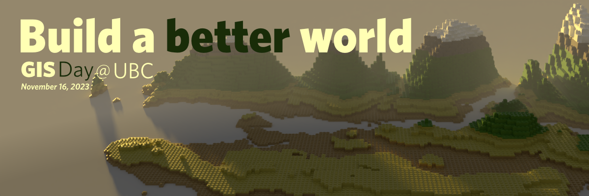
 GIS day 2023 is coming soon! Join us on November 16th, 2023 at the Dodson Room, Number 302, Third Floor, of the Irving K Barber Learning Centre at the University of British Columbia Vancouver campus.
GIS Day is an annual worldwide celebration of Geographic Information Systems (GIS) technology and community, with a goal to promote geospatial literacy, education, and awareness. Target audiences for GIS Day include students, educators, and researchers with interest in academic areas touching on geography, cartography, geographic information systems/science, maps, etc. Everyone is welcome!
GIS Day 2023 Program
Lightning talks
10:00
Fitz Dawson (He/him)
Quantifying reforestation of Mangroves in Madagascar using remote sensing techniques.
An investigation into the different sensors and indices that can be used to track and measure the progress of reforestation projects in western Madagascar. Comparing Planet and Sentinel data through a number of indices, and attempting to identify if/when the Google Earth Engine Mangrove Mapping Methodology can be used by forest managers to monitor projects.
10:10
Skyler Li (She/her)
The Application of Google Earth Engine Mangrove Mapping Methodology in Senegal
Mangroves are distributed in tropical and subtropic areas near water in more than 120 countries (The World’s Mangroves 1980-2005, n.d.). They provide crucial biodiversity values to the ecosystem and provide building materials and fishing environments to the local communities (Jones et al., 2016). Moreover, the mangrove ecosystem’s carbon dioxide sequestration capacity helps mitigate global climate change (Donato et al., 2011). Given the diverse ecosystem and economic values, mapping how mangroves change over time is crucial for mangrove management and protection.
In 2020, the Google Earth Engine Mangrove Mapping Methodology (GEEMMM) was introduced to accessibly map and monitor mangroves (Yancho et al., 2020). The mapping task may be complex if the study area is large given its accessible features (Yancho et al., 2020). The module in GEEMMM automatically gives the result of mangrove dynamics using multi-data maps (Yancho et al., 2020). GEEMMM can be used to map sub-national mangrove dynamics to demonstrate the change of mangrove species as well as deforestation and recovery status in Saloum Delta, Senegal.
10:20
Stephanie Yang
Enhancing Wetland Soil Data Analysis in BC
10:30
Colin Rodger
I’m a graduate student in UBC’s MGEM program. I have field experience in forestry, marine biology, and environmental monitoring.
Hotspot Analysis: Mangrove Restoration
Selecting a location for a restoration project is like standing in front of a fire with a few buckets of water–we have limited resources and need to optimize our efforts. Hotspot analysis is an optimization approach for deriving the most suitable project location. We can leverage spatial datasets to analyze areas of interest against the criteria guiding the restoration efforts. This lightning talk outline a subnational level hot-spot analysis for the NGO Blue Ventures to determine the most suitable location for their next mangrove restoration project.
Speakers
10:40
Tom Koch
Tom Koch is an adjunct professor of medical geography at the University of British Columbia. He is the author of a number of books on the history of medical mapping and papers in which he has demonstrated its utility in understanding both local outbreaks and pandemic events
GIS and Public Health: Mapping diseases and their causes
This brief talk reviews some of the ways in which mapping serves not only descriptively but in the analysis of bacterial and viral events and the policies we promote to contain them.
Social time
11:00
Lunch
11:30
Workshop
12:30
Building Distorted Worlds With GIS
In this workshop the UBC GIS club will teach users how to manipulate spatial data to build fictional worlds. In doing so, users will learn to use a suite of geoprocessing tools in the unconventional way of creating a fictional space using real-world data. This event is suited for people with beginner to advanced GIS skills alike and can be done on both ArcGIS and QGIS.
Break
14:30
Speakers
14:40
Paul Pickell
Paul Pickell is an Assistant Professor of Teaching in the Faculty of Forestry at the University of British Columbia and a Faculty in Residence at the Emerging Media Lab. He primarily teaches GIS and remote sensing across multiple professional graduate programs. Many of the lab assignment materials he teaches with are also available as Open Educational Resources (OER) from his GitHub (pauldpickell). His research looks at the use of immersive virtual reality and augmented reality in teaching spatial reasoning. Various projects he has worked on include the construction of an augmented reality sandbox, publishing an interactive OER geomatics textbook, and the development of Minetest Classroom for teaching in a voxel-based sandbox video game.
An OpenStreetMap walking tour of UBC in a video game
Join Prof. Pickell on a virtual journey and explore campus in a free and open source software video game using free geospatial data from OpenStreetMap. You will see and interact with campus as no one has before. Prof. Pickell will discuss how geovisualization can be reimagined with the use of video game engines. You will learn how to create and play your own digital twin worlds in this feature release frenzy of the Minetest Classroom game, developed here at UBC.
15:05
Avery Everhart
Dr. Everhart is a sociospatial scientist, health geographer, and theorist. Her work bridges geographic information science, public health, demography, and critical data studies. She draws from feminist and critical race theories, intersectionality, and transgender studies to better understand the life chances, health, and lived experiences of marginalized communities. Dr. Everhart has published in journals from a diverse array of fields including Hypatia: A Journal of Feminist Philosophy, Journal of the American Medical Informatics Association, and Spatial & Spatio-Temporal Epidemiology. She also co-founded the non-profit academic organization the Center for Applied Transgender Studies.
Geographic Access to Healthcare: Transgender Health in Texas
While the extant literature has established that transgender people face significant barriers to accessing healthcare, no studies to date have offered an explicitly spatial analysis of their access to trans-specific care. This study aims to fill that gap by providing a spatial analysis of access to gender-affirming hormone therapy (GAHT) using Texas as a case study. We used the three-step floating catchment area method, which relies on census tract-level population data and location data for healthcare facilities to quantify spatial access to healthcare within a specific drive-time window, in our case 120 min. For our tract-level population estimates we adapt estimates of the rates of transgender identification from a recent data source, the Household Pulse Survey, and use these in tandem with a spatial database of GAHT providers of the lead author’s creation. We then compare results of the 3SFCA with data on urbanicity and rurality, as well as which areas are deemed medically underserved. Finally, we conduct a hot-spot analysis that identifies specific areas where health services could be planned in ways that could improve both access to GAHT for trans people and access to primary care for the general population. Ultimately, we conclude that our results illustrate that patterns of access to trans-specific medical care, like GAHT, do not neatly follow patterns of access to primary care for the general population and that therefore trans communities’ access to healthcare warrants specific, further investigation.
Break
15:30
Industry talks
15:40
Christian Berger & Sienna Emery
Technical Support Specialists
Local Ingenuity: Exploring FME’s Role in Real-world GIS Projects
Discover the exciting potential of integrating FME with GIS through local success stories. This presentation will share how real clients have employed FME to tackle spatial challenges, optimize workflows, and drive innovation in their respective fields. Get inspired to envision how you can harness FME’s robust capabilities in your future GIS endeavors.
16:00
Zane White
Zane White has a BSc in Environmental Geoscience and Geomatics from the University of Guelph. He has an immense passion for GIS and remote sensing, and tries to apply his education and training to solve problems that often lack spatial context. He currently operates as a GIS Specialist at Candrone, creating a wide array of high-quality LiDAR and photogrammetric deliverables, typically captured by RPAS. When he is not working on an immediate deliverable, he enjoys developing small software packages that assist in automating repetitive GIS tasks.
Real-World Challenges and their GIS Solutions – The Rabbit-hole of Geomatics
From spatially modelling GPS-denied caves and tunnels, to assisting in serious global conflicts via GIS, the world of remote sensing has a lot to offer. Many students and young professionals experience uncertainty regarding how they can apply their knowledge to solving real challenges in our spatial environment. This presentation aims to provide context to the world of geomatics and how one GIS professional uses their day to solve spatial problems with new and innovative solutions.
Social time
16:25-End
I want to go!
The workshop
Workshop: Building Distorted Worlds With GIS
In this workshop the UBC GIS club will teach users how to manipulate spatial data to build fictional worlds. In doing so, users will learn to use a suite of geoprocessing tools in the unconventional way of creating a fictional space using real-world data. This event is suited for people with beginner to advanced GIS skills alike and can be done on both ArcGIS and QGIS.
Registration is now closed for this session
General registration
This is not required, but recommended as we can notify you of any changes to the event.
General registration
 Celebrate GIS Day 2025 with Us!