
GIS Day 2025
Celebrate GIS Day 2025 with Us! GIS Day 2025 is coming soon! Join us on Wednesday, November 19th, 2025, at the Dodson Room in the Irving K. Barber Learning Centre at the University of British Columbia, Vancouver Campus. GIS Day is an annual worldwide celebration of Geographic Information Systems (GIS) technology and community, dedicated to promoting […]

Plugins in QGIS
This intermediate-level workshop is meant to extend basic knowledge of QGIS by exploring common plugins. By the end of this workshop, participants will be able to use plugins to Access dynamic basemaps hosted on web servers Query and download Open Street Map (OSM) data Geocode address data from a spreadsheet, and Create an interactive webmap […]

StoryMaps with ArcGIS Online
This workshop is a gentle introduction to creating StoryMaps using the ArcGIS Online platform designed for those new to mapping projects. StoryMaps offer a low-barrier way to visualize spatial narratives that can be shared with your friends, community, or stakeholders. The StoryMaps interface is quite intuitive, with drag and drop options that result in an […]
GIS and Spatial Tools Monthly Drop-In
Are you working on a GIS or digital spatial project and looking for support? Join the GIS Team at UBC Library and other researchers working on spatial projects for a collective drop-in working session. These sessions are meant to offer a collegial environment to share knowledge and ideas, dedicated time for you to work on […]

Telling Spatial Stories with Data
This introductory workshop is targeted toward scholars, practitioners, and researchers who are interested in finding ways to represent their data and research materials spatially. Rather than focusing on a single software or technical workflow, participants will be introduced to a variety of methods, tools, and platforms to create maps or spatial representations. Participants will also […]

Tools and Workflows in QGIS
This intermediate-level workshop is focused on common tools and workflows in QGIS. By the end of this workshop, participants will be able to set up a QGIS project, find and load data onto a basemap, edit vector data from inside the GIS interface, perform joins and selections, and answer spatial questions using basic vector analysis. […]
Esri Canada Scholarship 2024
Can you make a map? ESRI Canada Scholarship 2024 $2000 award + software & training • Deadline Tuesday, May 7, 2024 • Open to current UBC students Esri Canada GIS Scholarship is open to currently enrolled undergraduate and graduate students at UBC. Successful applicant(s) will receive: one-time payment of $2,000 three-year term license of ArcGIS […]
GIS Day 2023
GIS day 2023 is coming soon! Join us on November 16th, 2023 at the Dodson Room, Number 302, Third Floor, of the Irving K Barber Learning Centre at the University of British Columbia Vancouver campus. GIS Day is an annual worldwide celebration of Geographic Information Systems (GIS) technology and community, with a goal to promote […]
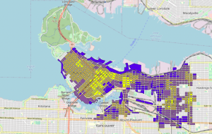
Georeferencing Historical Maps
This workshop offers an introduction to georeferencing historical maps with QGIS. Georeferencing is the process of taking a digital image or map and connecting it to a real world geographic coordinate system, allowing you to overlay historical and current maps, and to analyze relationships between them using GIS tools. Thursday, February 1, 2024 1 – […]

ESRI Canada Scholarship 2023
Can you make a map? ESRI Canada Scholarship 2023 $2000 award + software & training • Deadline Friday, March 31, 2023 • Open to current UBC students Each ESRI Scholarship applicant should provide no more than three or four pages, two pages of text and one or two pages of graphics (maps, tables, figures, models, […]