Esri Scholarships – 2019 (Deadline: March 22)
Submissions are open for two scholarships offered by Esri Canada Esri Canada’s annual GIS Scholarhsip Award recipients receive $2000, ArcGIS software, books, and training and networking opportunites. More info: Esri Canada GIS Scholarship 2019 2019 International Esri Young Scholars Award Applications are due March 22. The Esri Young Scholars Award program was launched in 2012 […]
Esri 2018 technical videos now available
The 2018 Esri User Conference Technical Workshops are now available for you to view. Watch them free of charge on Esri’s Youtube playlist. If you prefer print to video, or you simply want both, you can also access the PDF versions of the PowerPoint slides from each workshop on the Esri Events Proceedings page. The […]
Summer internship for graduate students
The UBC Sustainability Scholars Program is an innovative paid internship program that matches UBC graduate students with on- and off-campus sustainability partners to work on projects that support the advancement of sustainability in the region. A paid part-time summer internship available for a current graduate student with GIS experience. Applications are accepted on a rolling […]
Yuhao Lu from UBC Forestry wins Esri Canada’s 2018 Scholarship contest
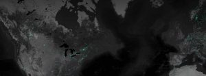
Global light trends mapped in ArcGIS Pro using a dark canvas proved to be a winning map submission for Yuhao Lu for Esri Canada’s 2018 Scholarship contest. This visualization using Visible Infrared Imager Radiometer Suite (VIIRS) images conceptualizes where the fastest growing cities are located in contrast to where declining cites exist using dark mapping. […]
Scholarship: Esri International Young Scholars Award
Are you an undergrad or grad student who has used Esri to complete a project? Interested in having your expenses paid for a visit to the International Esri User Conference in sunny San Diego this July? Esri Canada has announced their International Young Scholars Award that will pay for a student to go to San […]


