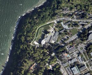
High resolution orthophotos for UBC-V Campus 2018 are now available on Abacus. These images provide complete coverage of campus and limited surrounding area at 10cm per pixel – fine enough to see view the details of buildings, vegetation, and other ground features. Images were processed by McElhanney Consulting Services of Vancouver and released by UBC Vancouver’s Campus and Community Planning Department with Public Domain License.
Orthophotos from this dataset are downloaded in ZIP format, which once extracted contain a TIF file with detailed imagery, as well as several side-car files essential to use in GIS software – such as an OVR pyramid file and world file. The uncompressed TIF file can also be used in image editing software if not needed for geospatial processing or analysis.
The image files are organized and distributed for download on a grid. This index map represents the grid layout complete with file names to help you determine which name covers what area of campus.
Click on an area below to see it’s tile ID number, then download the correct tile in Abacus.
