GIS Day 2020
GIS Day is an annual worldwide celebration of Geographic Information Systems (GIS) technology and community. GeoAwareness Week is an annual event highlighting the importance of geographic and spatial literacy and education. This year UBC Library and SFU Library are organizing four events in celebration of GeoAwareness Week and GIS Day: Intro to Web Mapping – […]

2020 Esri User Conference
Register for the 2020 Esri User Conference July 13–15, 2020 Have you ever wanted to attend the Esri User Conference in San Diego but were unable to attend? Now you can have the joy of attending without being rocketed across the continent in a pressurized cylinder. The Esri User Conference is now online, and it’s […]
Esri Scholarships – 2020 (Deadlines: February 24th and 28th)
Submissions are open for two scholarships offered by Esri Canada Esri Canada’s annual GIS Scholarhsip Award recipients receive $2000, ArcGIS software, books, and training and networking opportunites. The award includes registration for one of Esri Canada’s User Conferences in 2020. For more information: Esri Canada Scholarship 2020 Applications for this scholarship are due Monday, February […]
GIS Day 2019
GIS Day is an annual worldwide celebration of Geographic Information Systems (GIS) technology and community. GeoAwareness Week is an annual event highlighting the importance of geographic and spatial literacy and education. This year UBC Library, UBC Faculty of Forestry, and UBC Advanced Research Computing are organizing two events during GeoAwareness Week: Introduction to R as […]

Esri Scholarships – 2019 (Deadline: March 22)
Submissions are open for two scholarships offered by Esri Canada Esri Canada’s annual GIS Scholarhsip Award recipients receive $2000, ArcGIS software, books, and training and networking opportunites. More info: Esri Canada GIS Scholarship 2019 2019 International Esri Young Scholars Award Applications are due March 22. The Esri Young Scholars Award program was launched in 2012 […]
GeoAwareness Week and GIS Day, 2018
GIS Day is an annual worldwide celebration of Geographic Information Systems (GIS) technology and community. GeoAwareness Week is an annual event highlighting the importance of geographic and spatial literacy and education. This year UBC Library, UBC Faculty of Forestry, and SFU Library are organizing celebrations on two days during GeoAwareness Week: Tuesday, November 13th, 2018 […]
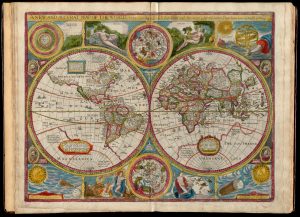
Submit a (John) Speed Presentation Proposal
Presentations will be held at SFU’s downtown campus on GIS Day during GeoAwareness Week, 2018 EXTENDED Deadline for submission: October 12, 2018 Are you working on a project or research involving geographic information systems (GIS), geospatial data, cartography, or maps? Are you interested in sharing your knowledge and work with the larger SFU and UBC […]
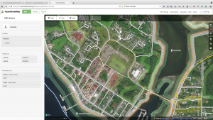
OpenStreetMap Mapping Party
Join UBC Library for an introductory session and mapping party where we will contribute to the freely accessible, non-commercial dataset of the world – OpenStreetMap (OSM). Contributions from this mapping party are toward Building Canada 2020 (BC2020i) – a nation-wide initiative to map all of Canada’s buildings by 2020. With the aid of aerial imagery, […]